Fall Foliage Road Trip in Arkansas

The Scenic 7 Byway in Arkansas passes through the Ozark and Ouachita Mountains.
Story and photos by Joe Howard
Joe Howard is a landscape photographer from St. Louis, Missouri. You can find him on Instagram.
Scenic drives in the Ozark Mountains showcase autumn’s rich colors.
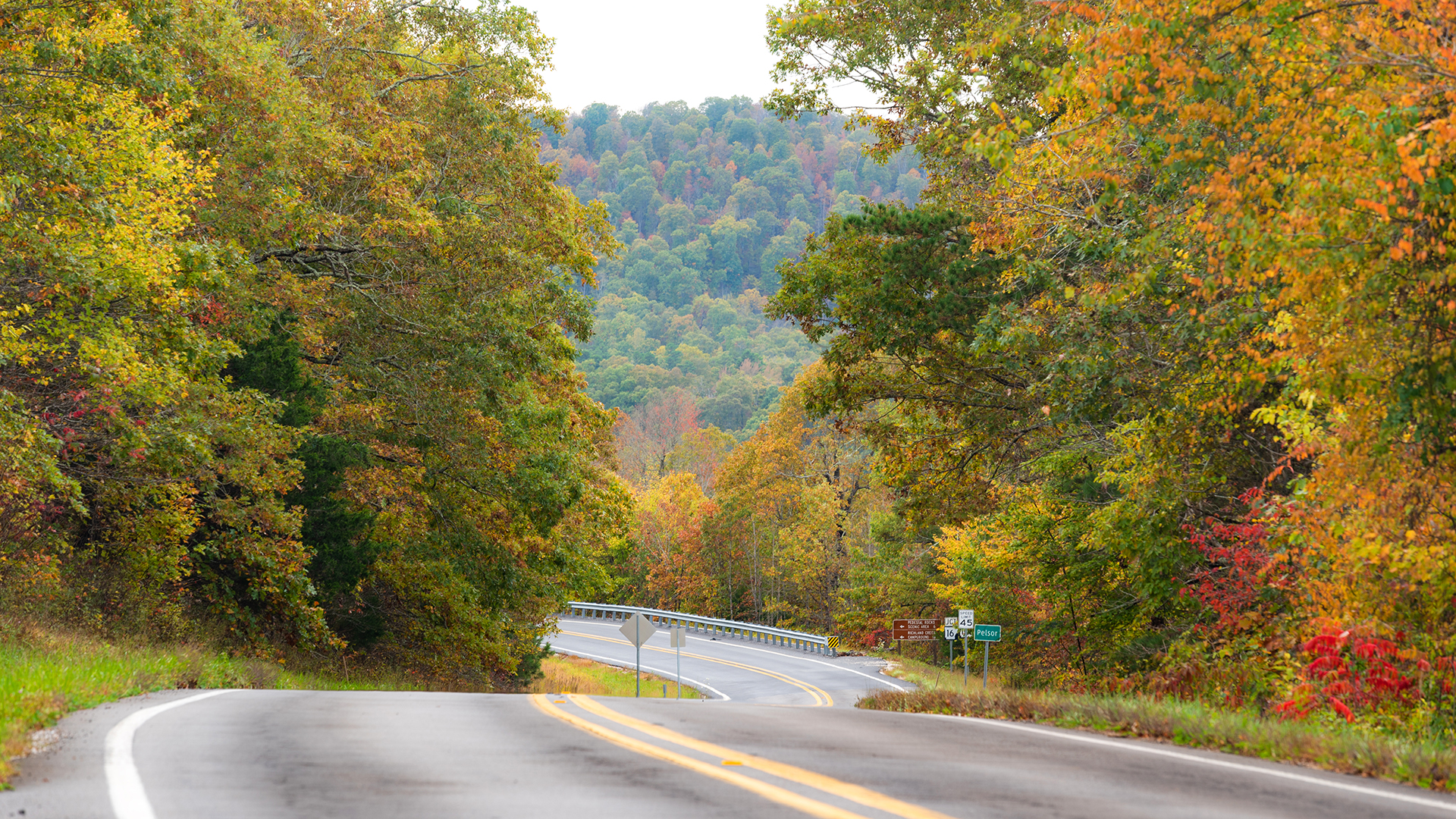
The wooded Ozark Mountains put on a spectacular show in autumn, and on a timely road trip through Arkansas, you can score front-row seats. Late in October and early in November, the leaves on the sugar maples, red maples and Chinese Pistache trees in and around the Ozark National Forest all are ablaze in reds, oranges and golds.
The Natural State also lays claim to memorable views of deep valleys, tumbling waterfalls and even an undammed river. Plus, northwest Arkansas is home to eight state parks with over 300 miles of mountain biking trails — a guaranteed lure for outdoor enthusiasts. An easy weekend road trip from St. Louis, Kansas City, Oklahoma City or Little Rock, the region offers both beauty and solace, a combination not always available in national parks.
As a landscape photographer, I’ve always had a special connection to the scenery in Arkansas. The mountains — some of the oldest on the planet — are heavily forested, caves are abundant and the summer night skies yield spectacular views of the Milky Way. On my first road trip to Arkansas in autumn, the Scenic 7 Byway and the Pig Trail Byway illustrated the best the state has to offer that time of year.

Arkansas Razorback fans are very familiar with the Pig Trail.

The Alum Cove Natural Bridge is only a short detour off Highway 7.
Scenic 7 Byway and Side Trips
The Scenic 7 Byway extends from near Harrison, about 30 minutes south of the Missouri border, south to El Dorado, near the Louisiana border. The first designated scenic byway in the state, the 290-mile route takes you through the Ozark and Ouachita Mountains and the rolling hills of the West Gulf Coastal Plain of Southern Arkansas. Due to time constraints, I decided to only drive the northern section.
Soon after you head out from Harrison, you’ll be driving in the Ozark National Forest, where the winding road showcases views of the forested mountains. Stop at the Cliff House Inn in Jasper, which perches on top of a mountain that overlooks the wide valley dubbed the Arkansas Grand Canyon. The Buffalo National River, one of the longest undammed rivers west of the Mississippi, sculpted this gorge, which features walls 1,000 feet deep.
Farther along, a short detour down Highway 16 to Alum Cove Natural Bridge leads you to the remains of a quartz sandstone cave. The bridge at the entrance is over 100 feet long and more than 20 feet wide. I hiked a mile-long loop trail for a good look at it and then walked across the top. About 18 miles farther south, I stopped at the Rotary Ann Rest Overlook, designated Arkansas’ first official rest stop some 80 years ago. It’s a great spot to take in views of autumn leaves.
The most popular hike in Arkansas is to Hawksbill Crag, a natural attraction that sits between Highway 7 and Highway 23. If the side trip appeals, leave Highway 7 at Highway 16 near Deer and follow it for 30 miles to County Road 5. Seven miles in, the parking lot is on your right. During the 4-mile, moderately difficult hike one weekday, I passed only a few hikers.
Back on Highway 7, 80 miles from Harrison, head down Highway 154 for 12 miles to Petit Jean State Park, just southeast of Russellville. Petit Jean (“Little John”) is named for a young Frenchwoman who in the 1700s disguised herself as a man so she could explore part of the Louisiana Territory. She died before the expedition returned to France, and legend has it that she asked to be buried on the mountain now named for her. The overlook near the gravesite features beautiful vistas of the Arkansas River, especially at sunrise or sunset.
The park’s Cedar Creek Trail is best known for a 95-foot-tall waterfall. The trail also includes Rock House Cave, a large rock shelter that is the premier spot in the state for viewing Native American cave paintings created over 500 years ago. Petit Jean State Park also is home to fossils and geological formations, including Turtle Rocks.

Rock House Cave at Petit Jean State Park

The Pig Trail features countless switchbacks and banked turns.
The Pig Trail Drive
The Pig Trail Scenic Byway, a section of Arkansas Highway 23, is a shortcut that football fans from southern Arkansas use to get to Fayetteville to watch the Arkansas Razorbacks play. Just 19 miles long, the Pig Trail starts in Brashears in Madison County and ends at Interstate 40 in the town of Ozark. The winding road features many switchbacks, pull-offs and overlooks. In addition to leaf peepers and football fans, the byway attracts motorcyclists.
South of Brashears, you’ll drive through the Ozark National Forest, which spans 1.2 million acres. Stop at the Cherry Bend Recreation Area to hike part of the Ozark Highlands National Recreation Trail, which extends some 156 miles from Lake Fort Smith State Park to the Buffalo National River. Ready for a rest? Follow Cass Oark Road off the Pig Trail for 3 miles to the Redding Recreation Area on the Mulberry River.
Back on the Pig Trail, drive south just over 2 miles to the Turner Bend Store, which stocks everything you may need (and then some) for your road trip. You also can rent canoes, kayaks or rafts for an adventure on the Mulberry River. Book a cabin or make camping reservations if you’re staying in the area. Don’t miss the photo opportunity at the Mulberry River Bridge, which is on the National Register of Historic Places.
A few miles farther south, a banked turn reveals the 15-foot Pig Trail Falls, just a few feet off the side of Highway 23. Another mile south and you’re in Ozark, where the Paradise Pizza Pub — open Thursday through Sunday — features pizzas named after characteristics of the Pig Trail (Switchback, Curvy & Steep, Overlook) and delicious homemade desserts.
Brilliant autumn drives, tumbling waterfalls and the promise of great pizza — that’s Arkansas!

The Turner Bend store offers outdoor supplies for roadtrippers
Related
Read more stories about Arkansas.
- Arkansas Trips
- Fall Foliage Road Trip in Arkansas
- Things to Do in Hot Springs, AR on Your Next Getaway
- Crater of Diamonds


